
Garmin GPS 73
4.4Editor score
SAILASSIST sailing features included
Intuitive backlit button interface
Long battery life on AA cells
Navigating the open water requires reliable technology to ensure safety and efficiency during every trip. A handheld GPS for boating provides essential positioning data when your main chartplotter fails or when you are away from the vessel.
We compared ten top models based on durability, satellite accuracy, map quality, and battery life. Our analysis focuses on devices that float, resist water, and offer clear displays in bright sunlight for optimal marine use.
Each pick highlights unique strengths for different boating styles and budgets. Prices fluctuate frequently so please check current listings before purchasing to ensure you get the best value for your navigation investment.
4.4Editor score

4.0Editor score
4.2Editor score
As an Amazon Associate we earn from qualifying purchases.
The following table offers a side-by-side overview of the ten selected devices highlighting their key specifications to help you make an informed decision for your marine adventures.



The Garmin GPSMAP 79sc stands out as a top choice for marine navigation with its rugged floating design and high-resolution display. It holds a strong rating for reliability and offers extensive mapping capabilities right out of the box.
We may earn a commission when you buy through this link, at no additional cost to you.
This device excels in accuracy thanks to support for multiple satellite constellations including GPS GLONASS and Galileo. The built-in compass and barometric altimeter provide critical data for situational awareness while on the water.
While the price is higher than basic units the investment pays off in durability and preloaded chart data. The interface may take some time to learn but the features justify the effort for serious boaters.
Boaters seeking a reliable handheld backup or primary navigation tool will find this unit invaluable. It is highly recommended for those who need detailed coastal charts and robust performance in harsh conditions.
The floating design ensures the device stays visible if dropped overboard while the water-resistant rating protects against splashes and rain.
Preloaded BlueChart g3 maps provide immediate access to coastal data including depths and hazards without needing extra purchases.
We may earn a commission when you buy through this link, at no additional cost to you.
The Garmin GPSMAP 79s offers a cost-effective solution for boaters needing reliable tracking without the high cost of detailed coastal charts. It shares the rugged floating build of its sibling but focuses on basic navigation utility.
We may earn a commission when you buy through this link, at no additional cost to you.
Its strength lies in the worldwide basemap and robust battery life which makes it ideal for long trips where detailed charts are less critical. The display remains clear even in bright sunlight conditions.
Users should note the absence of preloaded coastal maps which might require additional purchases for specific regions. However for general position tracking this unit performs exceptionally well for the price.
This device is perfect for boaters who already have chartplotters on board and need a simple backup tracker. It is a smart choice for those prioritizing durability and battery over advanced mapping features.
Support for multiple satellite systems ensures you maintain a lock on your position even in remote or challenging environments.
With up to 20 hours of battery life in GPS mode you can rely on this device throughout a full day on the water.
We may earn a commission when you buy through this link, at no additional cost to you.
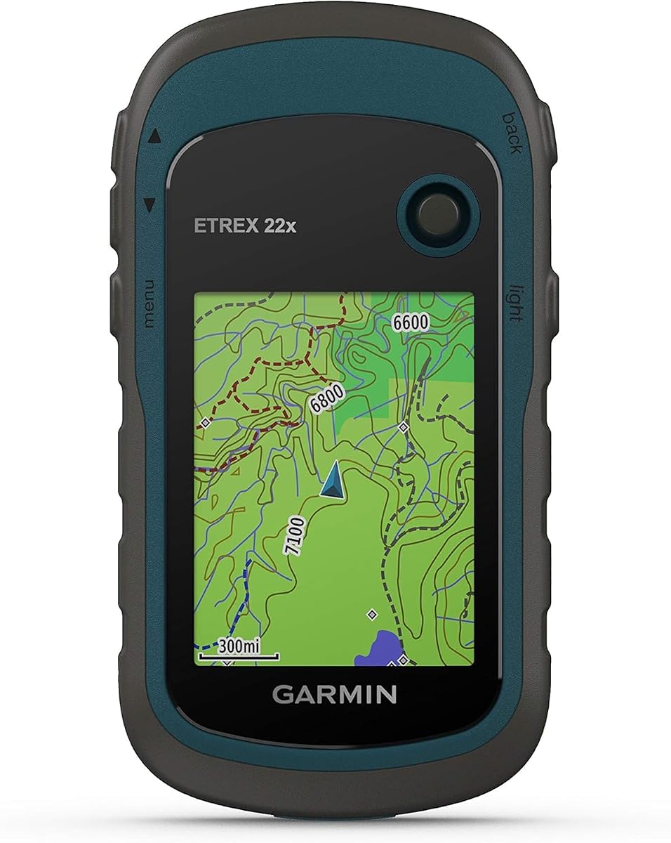
The Garmin eTrex 22x is a versatile navigator that brings rugged durability to the water. While often used for hiking its robust build and long battery life make it a strong contender for marine backup needs.
We may earn a commission when you buy through this link, at no additional cost to you.
It features a generous 8 GB of internal memory plus a micro SD slot allowing you to load custom marine charts if desired. The 2.2 inch display remains readable even under direct sun glare.
The trade-off is that it comes with Topo Active maps rather than specialized marine charts. Users may need to manage map data carefully to get the most out of its navigation capabilities.
This model suits adventurous boaters who also hike and want one device for multiple outdoor activities. Its reliability and ease of use make it a trustworthy partner for diverse exploration.
The micro SD card slot allows you to expand storage and download specific map data that fits your boating regions.
Powered by two AA batteries it offers up to 25 hours of continuous use ensuring you stay navigated all day long.
We may earn a commission when you buy through this link, at no additional cost to you.
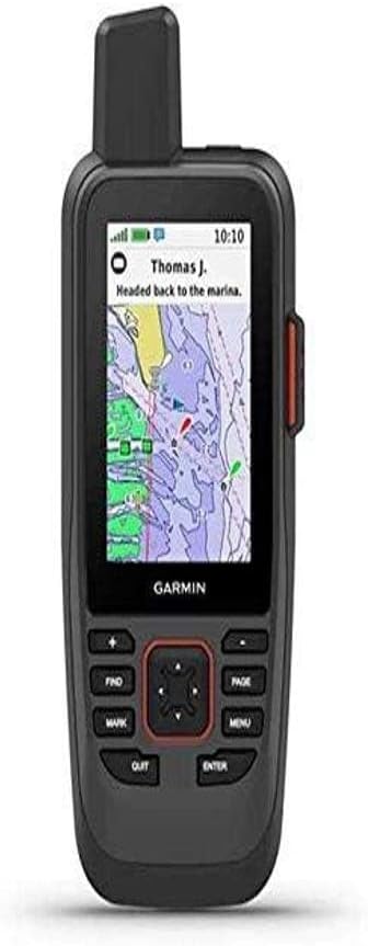
The Garmin GPSMAP 86Sci represents the pinnacle of marine handheld navigation with integrated satellite communication features. It combines essential GPS tracking with the ability to send and receive messages globally.
We may earn a commission when you buy through this link, at no additional cost to you.
Its ability to stream data from onboard chartplotters consolidates information into one handheld device. Preloaded BlueChart G3 maps ensure you have detailed coastal data for safe navigation along shorelines.
The main drawback is the requirement for a satellite subscription to utilize communication features which adds to the cost. However for safety conscious boaters the connectivity benefits are often worth the investment.
This unit is ideal for serious sailors and cruisers who venture far from shore. It provides peace of mind through SOS capabilities and the ability to share your location with loved ones.
The built-in InReach technology allows you to trigger an interactive SOS and message search and rescue centers anytime.
You can stream vital boat data directly to this device from compatible instruments reducing the need for multiple displays.
We may earn a commission when you buy through this link, at no additional cost to you.
The Garmin GPS 73 is designed specifically with sailors in mind offering dedicated features like virtual starting lines and tack assist. It is a compact unit that prioritizes ease of use over complex mapping.
We may earn a commission when you buy through this link, at no additional cost to you.
With a straightforward interface and dedicated backlit buttons this device is easy to operate even in stressful conditions. It stores enough waypoints for most casual trips while maintaining a low profile.
The lack of a visual map might be a limitation for those needing detailed route planning on the device itself. However for tracking position and timing it remains a reliable tool for sailboats.
This model is perfect for small boat owners and sailors who prefer simplicity. Its specialized features make it a valuable asset for race timing and routine coastal cruising.
Features such as speed history and anchor drag alarms are tailored to the unique needs of sailing navigation.
The dedicated buttons eliminate the need for complex menus ensuring quick access to critical navigation data when needed.
We may earn a commission when you buy through this link, at no additional cost to you.
Buying a renewed device like the Garmin GPSMAP 79sc offers a smart way to access premium features at a reduced price. It maintains the same core navigation capabilities and rugged build as the brand new version.
We may earn a commission when you buy through this link, at no additional cost to you.
The high rating for this renewed option suggests that previous owners have validated its performance and durability. It includes the same BlueChart g3 maps and floating design essential for marine safety.
While cosmetic wear might be present the internal components are tested to ensure reliable function. This option allows budget conscious boaters to get top tier technology without the full retail price.
This pick is best for those comfortable with certified refurbished tech. It provides an excellent entry point into high-end marine navigation with significant savings.
Renewed units undergo testing to ensure they meet quality standards for functionality and performance.
Accessing high-end features like BlueChart mapping is possible at a much lower cost compared to buying new.
We may earn a commission when you buy through this link, at no additional cost to you.
The Garmin GPSMAP 65 distinguishes itself with multi-band technology that delivers superior accuracy even in challenging environments. Its large 2.6 inch screen provides ample room for viewing route information and maps.
We may earn a commission when you buy through this link, at no additional cost to you.
It comes preloaded with TopoActive maps which are useful for general navigation but not tailored for marine use. The device integrates well with the Explore website for managing your tracks and waypoints.
For boaters who prioritize pinpoint accuracy in difficult conditions this technology is a significant advantage. However those needing detailed coastal charts will need to manage expectations or add maps later.
This device suits boaters who need a versatile GPS for both land and water activities. It balances advanced technology with a user-friendly design effectively.
Multi-band GNSS support ensures you maintain a strong satellite connection even in areas with dense tree cover or urban canyons.
Syncing with the Garmin Explore app allows for easy trip planning and sharing of your outdoor adventures.
We may earn a commission when you buy through this link, at no additional cost to you.
The Garmin eTrex 32x builds on the reputation of the eTrex series with added sensors like a 3-axis compass and barometric altimeter. These features provide enhanced situational awareness useful for navigating diverse terrains.
We may earn a commission when you buy through this link, at no additional cost to you.
Its 8 GB internal memory and micro SD slot allow for substantial map storage flexibility. The display remains clear in bright conditions which is critical when looking up from a console or deck.
While it is robust the unit is not waterproof to the same degree as dedicated marine units so caution is required. It is best used as a backup rather than a primary water exposed device.
This model is ideal for boaters who hike onshore and want a single tool for both activities. It delivers reliable performance with essential navigation features at a reasonable price.
The addition of a barometric altimeter and electronic compass provides critical data for orientation even when stationary.
With 8 GB internal plus SD card support you can store multiple detailed map layers for different destinations.
We may earn a commission when you buy through this link, at no additional cost to you.
The Garmin eTrex SE offers outstanding battery life that can last weeks in expedition mode making it suitable for long voyages. It features a water-resistant design that can handle rain and splashes effectively.
We may earn a commission when you buy through this link, at no additional cost to you.
Pairing with the Garmin Explore app provides access to Active Weather and automatic cache updates. These features enhance usability for outdoor enthusiasts who want connectivity without complex setups.
It lacks preloaded marine charts but serves well as a position tracker with reliable satellite support. The long battery life reduces the anxiety of running out of power during extended trips.
This device is perfect for extended trips where recharging options are limited. It balances basic navigation with modern app features for a flexible user experience.
With up to 168 hours in standard mode you can rely on this device for long term trips without frequent changes.
Wireless updates via the Explore app keep your software current and provide weather forecasts on the go.
We may earn a commission when you buy through this link, at no additional cost to you.
The Garmin GPS 76 is a classic device known for its simplicity and WAAS enabled accuracy. It provides a straightforward way to track position without overwhelming features or complex interfaces.
We may earn a commission when you buy through this link, at no additional cost to you.
Its trip computer displays current and average speed which is useful for monitoring boat performance. The 16 hour battery life ensures it can last through most day trips without recharge.
While modern units offer more memory and better screens this model remains a reliable option for basic tracking. Its compact size makes it easy to store in a glove box or small bag.
This device is suitable for boaters who need a simple backup or backup tracker without extra bells and whistles. It remains a trusted choice for straightforward navigation tasks.
A simple interface with essential tools ensures quick access to data without navigating complex menus.
WAAS enabled technology helps maintain accurate position data which is crucial for safe navigation on open water.
We may earn a commission when you buy through this link, at no additional cost to you.
Selecting the right handheld GPS for boating involves evaluating several key features to ensure safety and reliability on the water.
A handheld GPS for boating must be rugged enough to withstand splashes and rain. Look for an IPX6 or higher rating to ensure the device can survive harsh marine environments.
Durability is key when choosing a device that will face salt spray and rough handling. A sturdy build ensures the unit survives accidents and drops on deck.
Floating capability is a crucial safety feature for marine electronics. If a device is dropped overboard a floating design keeps it visible and retrievable.
Many top models are engineered to float which adds peace of mind during active boating trips. Ensure the device floats upright to keep the screen visible.
Preloaded marine charts such as BlueChart g3 offer immediate navigation benefits. High-quality maps show water depths and hazards essential for safe route planning.
Check if the device includes detailed coastal maps or if you need to purchase them separately. Good chart quality helps you avoid grounding and navigate confidently.
Multiple satellite system support like GPS GLONASS and Galileo improves accuracy in challenging conditions. More satellites in view mean faster lock times and reliable tracking.
Multi-band technology further enhances precision especially in areas with interference. Prioritize models with broad satellite support for consistent performance.
The display must be sunlight-readable to ensure you can see data outdoors. A high-resolution color screen improves map details and navigation clarity.
Screen size affects usability during navigation. A larger display reduces strain on the eyes when reviewing routes while at sea.
Long battery life is essential for extended trips where recharging may be difficult. Look for devices offering 15 hours or more of continuous operation.
Consider whether the device uses standard AA batteries or rechargeable lithium. Standard AA cells are easier to replace in remote areas without power sources.
Ample storage allows you to track numerous waypoints and routes for future trips. A device with 10000 waypoints or more accommodates detailed route planning.
Expandable storage via micro SD card is a bonus for storing large map files. Ensure the unit supports additional memory if you need detailed charts.
Extra features like compass altimeter and satellite communication add value to a handheld GPS. Safety tools like SOS capabilities enhance security far from shore.
Connectivity options such as Wi-Fi or Bluetooth enable updates and data sharing. Modern features keep the device relevant as mapping software evolves.
To ensure accurate readings allow your handheld GPS for boating to acquire satellite signals before setting off. Keep the device clear of metal obstructions and antennas for optimal performance.
Regularly update the device firmware and map data through the manufacturer app. Staying current ensures you benefit from the latest route corrections and software improvements.
Clean the unit with fresh water after each use to remove salt residue. Store it in a dry protective case when not in use to extend its lifespan.
Most handheld GPS units are water-resistant rather than fully waterproof. Look for IPX6 or IPX7 ratings which guarantee protection against rain and splashes. Submerging the device beyond these limits can still cause damage.
Basic navigation does not require a subscription. However satellite communication features like SOS messaging often need a plan. Check the terms before purchase if you plan to use messaging services.
Many models support micro SD cards for adding extra map data. Check the manual to see supported file formats and memory limits. This allows you to load specific regional charts easily.
Battery life varies from 16 to 25 hours on standard AA batteries. Some units offer expedition modes to extend runtime further. Always carry spare batteries for extended trips on open water.
A floating design ensures the device remains retrievable if it falls overboard. It keeps the screen above water for easy visibility during retrieval. This simple feature adds significant safety value for any boat owner.
Open water typically offers excellent satellite reception due to few obstructions. In harbors with tall buildings or bridges signal might be weaker. Ensure your GPS supports multiple systems for better reliability.
The Garmin GPSMAP 79sc leads our list with its comprehensive features and rugged build. It balances advanced mapping with practical safety features for a wide range of users.
Prioritize water resistance and battery life when selecting a device for marine use. These factors ensure you stay safe and powered through long days on the water.
Check current prices and listings before purchasing to find the best deal. Technology evolves quickly so keeping your options open helps secure the right tool for your needs.